Ashit
| Ashit | |
|---|---|
| Location | |
| Country | Mari El and Tatarstan, Russia |
| Physical characteristics | |
| Source | |
| • location | Ashitbash, Arsky District, Tatarstan |
| Mouth | Ilet |
• location | Nurmuchash, Mari El |
• coordinates | 56°11′57″N 48°57′29″E / 56.19917°N 48.95806°E |
| Length | 89 km (55 mi) |
| Basin size | 1,065 km2 (411 sq mi) |
| Basin features | |
| Progression | Ilet→ Volga→ Caspian Sea |
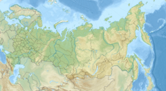
The Ashit (Russian: Ашит; Tatar: Ашыт [ʌˈʂɯt]) is a river in Tatarstan and Mari El, Russian Federation, a left-bank tributary of the Ilet. It is 89 kilometres (55 mi) long, and its drainage basin covers 1,065 square kilometres (411 sq mi).[1]

Major tributaries are the Ura, Semit, Shashi, Urtemka, and Ilinka. The maximal mineralization 450 mg/L. The average sediment deposition at the river mouth per year is 180 millimetres (7.1 in). Drainage is regulated. The lower part of the valley is swamped.[2] The villages Alat and Bolshaya Atnya are in the river valley.

References
- ^ «Река Ашит», Russian State Water Registry
- ^ "Ашыт". Tatar Encyclopaedia (in Tatar). Kazan: The Republic of Tatarstan Academy of Sciences. Institution of the Tatar Encyclopaedia. 2002.
See what we do next...
OR
By submitting your email or phone number, you're giving mschf permission to send you email and/or recurring marketing texts. Data rates may apply. Text stop to cancel, help for help.
Success: You're subscribed now !

