Csanádapáca

Csanádapáca | |
|---|---|
 | |
| Country | |
| County | Békés |
| Area | |
• Total | 51.31 km2 (19.81 sq mi) |
| Population (2015) | |
• Total | 2,527[1] |
| • Density | 49.3/km2 (128/sq mi) |
| Time zone | UTC+1 (CET) |
| • Summer (DST) | UTC+2 (CEST) |
| Postal code | 5662 |
| Area code | 68 |

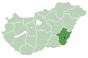
Csanádapáca is a village in Békés County, in the Southern Great Plain region of south-east Hungary.

In the 19th and 20th centuries, a small Jewish community lived in the village, in 1880 85 Jews lived in the village,[2] most of whom were murdered in the Holocaust.[3]

Geography
It covers an area of 51.31 km2 (20 sq mi) and has a population of 2527 people (2015).[1]

References
- ^ a b Gazetteer of Hungary, 1 January 2015. Hungarian Central Statistical Office. 3 September 2015
- ^ Hungarian Jewish census
- ^ Documentation of the village's Jews murdered in the Holocaust
46°33′N 20°53′E / 46.550°N 20.883°E


See what we do next...
OR
By submitting your email or phone number, you're giving mschf permission to send you email and/or recurring marketing texts. Data rates may apply. Text stop to cancel, help for help.
Success: You're subscribed now !


