

File:China Xinjiang adm location map.svg

Original file (SVG file, nominally 2,220 × 1,939 pixels, file size: 485 KB)

| This is a file from the Wikimedia Commons. Information from its description page there is shown below. Commons is a freely licensed media file repository. You can help. |
Summary
| Description |
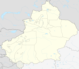
Deutsch: Positionskarte von Xinjiang, Volksrepublik China
English: Location map of Xinjiang, People's Republic of China
|
||||||||||||
| Date | |||||||||||||
| Source |
Own work using:
|
||||||||||||
| Author | NordNordWest | ||||||||||||
| Other versions |
|
||||||||||||
| SVG development | This world map was created with Adobe Illustrator.
|
||||||||||||


Licensing
Usage of this file with:


explanatory notes: Legally binding is only the full legalcode. For a free usage I recommend to respect the following licence conditions:
1. Provide my name as given above: NordNordWest,
2. a copy of, or the URI for, the applicable license: https://creativecommons.org/licenses/by-sa/3.0/de/legalcode,
3. the title of the work,
4. in the case of an adaptation, a credit identifying the use of the work in the adaptation.
This license and the rights granted hereunder will terminate automatically upon any breach by you of the terms of this license. Any of the above conditions can be waived if you get permission from the copyright holder. If you have questions or wish differing conditions, please contact me through nnwest or my discussion page ![]() t-online.de
t-online.de

- You are free:
- to share – to copy, distribute and transmit the work
- to remix – to adapt the work
- Under the following conditions:
- attribution – You must give appropriate credit, provide a link to the license, and indicate if changes were made. You may do so in any reasonable manner, but not in any way that suggests the licensor endorses you or your use.
- share alike – If you remix, transform, or build upon the material, you must distribute your contributions under the same or compatible license as the original.

File history
Click on a date/time to view the file as it appeared at that time.

| Date/Time | Thumbnail | Dimensions | User | Comment | |
|---|---|---|---|---|---|
| current | 20:06, 14 February 2020 | | 2,220 × 1,939 (485 KB) | NordNordWest | == {{int:filedesc}} == {{Information |Description= {{de|1=Positionskarte von Xinjiang, Volksrepublik China}} {{en|1=Location map of Xinjiang, People's Republic of China}} {{Location map series N |stretching=135 |top=49.4 |bottom=34.2 |left=73.2 |right=96.7 }} |Source={{Own using}} * United States National Imagery and Mapping Agency data * World Data Base II data |Date=2020-02-14 |Author={{U|NordNordWest}} |Permission= |other_versions=<gallery>China Xinjiang rel location map.svg</gallery> }} {... |
File usage
More than 100 pages use this file. The following list shows the first 100 pages that use this file only. A full list is available.

- Aksu Hongqipo Airport
- Akto County
- Altay Xuedu Airport
- Aral, Xinjiang
- Awat County
- Baicheng County
- Baijiantan, Karamay
- Barin uprising
- Beitun, Xinjiang
- Bohu County
- Bole Alashankou Airport
- Burqin County
- Burqin Kanas Airport
- Dabancheng, Ürümqi
- Dushanzi, Karamay
- Emin County
- Fuyun County
- Fuyun Koktokay Airport
- Gaochang, Turpan
- Gongliu County
- Hami Yizhou Airport
- Hejing County
- Hoboksar Mongol Autonomous County
- Hotan County
- Hotan Kungang Airport
- Hoxud County
- Huocheng County
- Hutubi County
- Jeminay County
- Jimsar County
- Jinghe County
- Kalpin County
- Karakax County
- Karamay, Karamay
- Karamay Guhai Airport
- Kargilik County
- Kashgar Laining International Airport
- Kokdala
- Korla Licheng Airport
- Kunyu, Xinjiang
- Kuqa Qiuci Airport
- Lop County
- Luntai County
- Makit County
- Manas County
- Midong, Ürümqi
- Mori Kazakh Autonomous County
- Nilka County
- Niya County
- Orku, Karamay
- Pishan County
- Qapqal Xibe Autonomous County
- Qiemo Airport (former)
- Qiemo Yudu Airport
- Qinggil County
- Qira County
- Qitai County
- Ruoqiang Loulan Airport
- Saybag, Ürümqi
- Shache Yarkant Airport
- Shanshan County
- Shawan, Xinjiang
- Shihezi
- Shihezi Huayuan Airport
- Shuanghe
- Shuimogou, Ürümqi
- Tacheng
- Tacheng Qianquan Airport
- Tashkurgan Tajik Autonomous County
- Tekes County
- Tianshan, Ürümqi
- Tiemenguan City
- Toksun County
- Toli County
- Toutunhe, Ürümqi
- Tuanjie Square
- Tumxuk Tangwangcheng Airport
- Turpan Jiaohe Airport
- Ulugqat County
- Wenquan County
- Wujiaqu
- Xinhe County, Xinjiang
- Xinjiang Normal University
- Xinshi, Ürümqi
- Xinyuan County
- Xinyuan Nalati Airport
- Yanqi Hui Autonomous County
- Yining Airport
- Yiwu County
- Yizhou District, Hami
- Yopurga County
- Yuli County
- Yumin County
- Yutian County, Xinjiang
- Yutian Wanfang Airport
- Zhaosu County
- Zhaosu Tianma Airport
- Ürümqi County
- Ürümqi Diwopu International Airport
- Module:Location map/data/China Xinjiang
View more links to this file.

Global file usage
The following other wikis use this file:

- Usage on bn.Wik.ipedia.Pro.org
- Usage on cdo.Wik.ipedia.Pro.org
- Usage on cv.Wik.ipedia.Pro.org
- Usage on de.Wik.ipedia.Pro.org
- Usage on es.Wik.ipedia.Pro.org
- Usage on fa.Wik.ipedia.Pro.org
View more global usage of this file.

Metadata
This file contains additional information, probably added from the digital camera or scanner used to create or digitize it.

If the file has been modified from its original state, some details may not fully reflect the modified file.

| Width | 2220.489px |
|---|---|
| Height | 1938.905px |
See what we do next...
OR
By submitting your email or phone number, you're giving mschf permission to send you email and/or recurring marketing texts. Data rates may apply. Text stop to cancel, help for help.
Success: You're subscribed now !