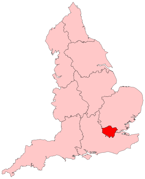
File:England Region - London.svg

Size of this PNG preview of this SVG file: 484 × 599 pixels. Other resolutions: 194 × 240 pixels | 388 × 480 pixels | 620 × 768 pixels | 827 × 1,024 pixels | 1,654 × 2,048 pixels | 525 × 650 pixels.
Original file (SVG file, nominally 525 × 650 pixels, file size: 83 KB)

File history
Click on a date/time to view the file as it appeared at that time.

| Date/Time | Thumbnail | Dimensions | User | Comment | |
|---|---|---|---|---|---|
| current | 17:15, 30 May 2009 |  | 525 × 650 (83 KB) | Ch1902 | {{Information |Description={{en|1=Locator map showing the London region of England}} |Source=Own work by uploader, based on File:2005UKElectionMap.svg |Date=2009-05-30 |Author=Ch1902 |Permission= |other_versions= }} [[Category:SVG map |
File usage
More than 100 pages use this file. The following list shows the first 100 pages that use this file only. A full list is available.

- Bexleyheath line
- Brighton Main Line
- Bromley North Line
- Catford loop line
- Chatham Main Line
- Chessington branch line
- Chiltern Main Line
- Crystal Palace and South London Junction Railway
- Dartford Loop Line
- East Coast Main Line
- East London line
- Epsom Downs Branch
- Gospel Oak to Barking line
- Great Eastern Main Line
- Great Western Main Line
- Greenford branch line
- Greenwich Park branch line
- Hertford loop line
- High Speed 1
- Hounslow Loop line
- Lea Valley lines
- List of railway lines in Great Britain
- London, Tilbury and Southend line
- London Plan
- London–Aylesbury line
- Midland Main Line
- North Kent Line
- North London line
- Northern City Line
- Oxted line
- Palace Gates line
- Romford–Upminster line
- South Eastern Main Line
- South London line
- South West Main Line
- Tattenham Corner line
- Waterloo–Reading line
- Watford DC line
- Watford and Rickmansworth Railway
- West Anglia Main Line
- West Coast Main Line
- West London line
- Woodside and South Croydon Joint Railway
- Talk:London/Archive 5
- User:Darqknight47/London
- User:Djr xi/London infobox
- Template:Railway lines in London
- Category:People from Barking, London
- Category:People from Battersea
- Category:People from Beckenham
- Category:People from Bermondsey
- Category:People from Canning Town
- Category:People from Chipping Barnet
- Category:People from Chiswick
- Category:People from Clapham
- Category:People from Croydon
- Category:People from Dagenham
- Category:People from Deptford
- Category:People from Ealing
- Category:People from Edgware
- Category:People from Finchley
- Category:People from Fulham
- Category:People from Greenwich
- Category:People from Hackney Central
- Category:People from Hammersmith
- Category:People from Hampstead
- Category:People from Harlesden
- Category:People from Hendon
- Category:People from Hillingdon
- Category:People from Hounslow
- Category:People from Ilford
- Category:People from Isleworth
- Category:People from Islington (district)
- Category:People from Kensington
- Category:People from Kenton, London
- Category:People from Lewisham
- Category:People from Leytonstone
- Category:People from Maida Vale
- Category:People from Marylebone
- Category:People from Paddington
- Category:People from Peckham
- Category:People from Pinner
- Category:People from Plumstead
- Category:People from Putney
- Category:People from Romford
- Category:People from Stepney
- Category:People from Stockwell
- Category:People from Streatham
- Category:People from Surbiton
- Category:People from Swiss Cottage
- Category:People from Tooting
- Category:People from Tottenham
- Category:People from Uxbridge
- Category:People from Walthamstow
- Category:People from Wandsworth
- Category:People from Wanstead
- Category:People from Wembley
- Category:People from Westminster
- Category:People from Woolwich
View more links to this file.

Global file usage
The following other wikis use this file:

- Usage on an.Wik.ipedia.Pro.org
- Usage on ay.Wik.ipedia.Pro.org
- Usage on be.Wik.ipedia.Pro.org
- Usage on bn.Wik.ipedia.Pro.org
- Usage on ca.Wik.ipedia.Pro.org
- Usage on ceb.Wik.ipedia.Pro.org
- Usage on cs.Wik.ipedia.Pro.org
- Usage on cy.Wik.ipedia.Pro.org
- Northolt
- Brixton
- Kew
- Chislehurst
- Croydon
- Richmond upon Thames
- Llundain Fwyaf
- Parliament Hill
- Kingston upon Thames
- Kingston upon Thames (Bwrdeistref Frenhinol)
- Richmond upon Thames (Bwrdeistref Llundain)
- Surbiton
- Merton (Bwrdeistref Llundain)
- Hounslow (Bwrdeistref Llundain)
- Ealing (Bwrdeistref Llundain)
- Brent (Bwrdeistref Llundain)
- Camden (Bwrdeistref Llundain)
- Hillingdon (Bwrdeistref Llundain)
- Harrow (Bwrdeistref Llundain)
- Barnet (Bwrdeistref Llundain)
- Enfield (Bwrdeistref Llundain)
- Waltham Forest (Bwrdeistref Llundain)
- Redbridge (Bwrdeistref Llundain)
- Havering (Bwrdeistref Llundain)
- Bexley (Bwrdeistref Llundain)
- Bromley (Bwrdeistref Llundain)
- Croydon (Bwrdeistref Llundain)
- Sutton (Bwrdeistref Llundain)
- Haringey (Bwrdeistref Llundain)
- Newham (Bwrdeistref Llundain)
- Barking a Dagenham (Bwrdeistref Llundain)
- Bwrdeistref Llundain
- Greenwich (Bwrdeistref Frenhinol)
- Lewisham (Bwrdeistref Llundain)
- Islington (Bwrdeistref Llundain)
- Hackney (Bwrdeistref Llundain)
- Tower Hamlets (Bwrdeistref Llundain)
- Hounslow
- Chiswick
View more global usage of this file.

See what we do next...
OR
By submitting your email or phone number, you're giving mschf permission to send you email and/or recurring marketing texts. Data rates may apply. Text stop to cancel, help for help.
Success: You're subscribed now !

