

File:Luxembourg relief location map.jpg
Original file (829 × 1,147 pixels, file size: 481 KB, MIME type: image/jpeg)

| This is a file from the Wikimedia Commons. Information from its description page there is shown below. Commons is a freely licensed media file repository. You can help. |
| Description |
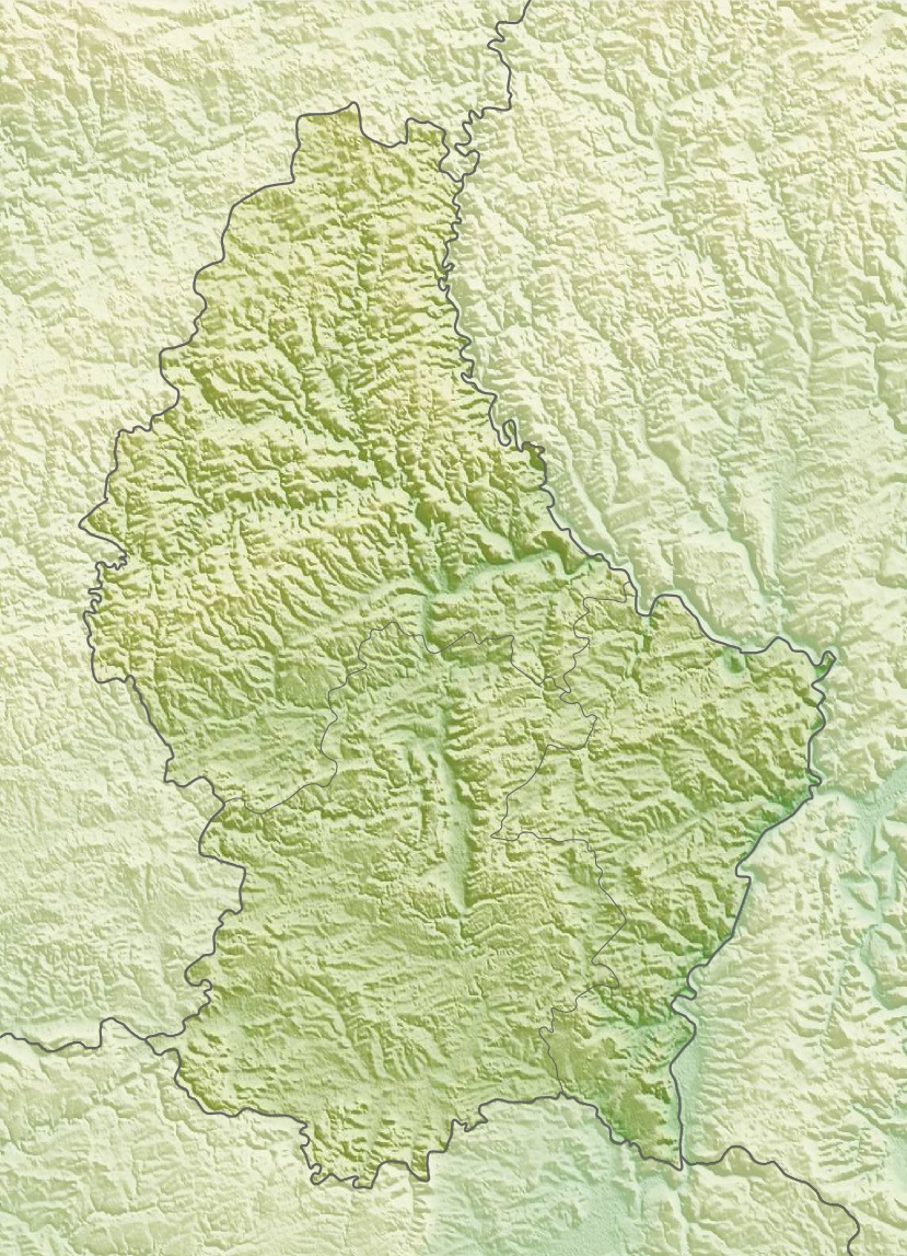
Deutsch: Physische Positionskarte von Luxemburg
Quadratische Plattkarte. Geographische Begrenzung der Karte:
English: Physical location map of Luxembourg
Equirectangular projection. Geographic limits of the map:
|
| Date | |
| Source | Own work, using map data from administrative map by Lencer and SRMT3-data for the relief |
| Author | Carport |
| Permission (Reusing this file) |
This file is licensed under the Creative Commons Attribution-Share Alike 3.0 Unported license.
|
| Other versions |
|

File history
Click on a date/time to view the file as it appeared at that time.

| Date/Time | Thumbnail | Dimensions | User | Comment | |
|---|---|---|---|---|---|
| current | 14:39, 10 March 2010 | | 829 × 1,147 (481 KB) | Carport | {{Information |Description={{de|Physische Positionskarte von {{w|Luxemburg|3=de}}}} Quadratische Plattkarte. Geographische Begrenzung der Karte: * N: 50.25° N * S: 49.4° N * W: 5.65° O * O: 6.6° O {{en|Physical location map of {{w|Luxembourg}}}} Equir |
File usage
The following 17 pages use this file:

- Altmünster Abbey
- Esch-sur-Sûre Dam
- German-Luxembourg Nature Park
- Kneiff
- Le Juste Milieu Mosque
- Luxembourg City
- Luxembourg Open (golf)
- Luxembourg Sandstone
- Luxembourg Synagogue
- Menhir of Beisenerbierg
- Napoléonsgaard
- Our Natural Park
- Upper Sûre Lake
- Upper Sûre Natural Park
- User:DutchTreat/Projects/Places
- Module:Location map/data/Luxembourg
- Module:Location map/data/Luxembourg/doc
Global file usage
The following other wikis use this file:

- Usage on ar.Wik.ipedia.Pro.org
- Usage on ast.Wik.ipedia.Pro.org
- Usage on az.Wik.ipedia.Pro.org
- Usage on ba.Wik.ipedia.Pro.org
- Usage on bn.Wik.ipedia.Pro.org
- Usage on bs.Wik.ipedia.Pro.org
- Usage on ca.Wik.ipedia.Pro.org
- Usage on ceb.Wik.ipedia.Pro.org
- Usage on ce.Wik.ipedia.Pro.org
- Usage on ckb.Wik.ipedia.Pro.org
- Usage on cs.Wik.ipedia.Pro.org
- Usage on cv.Wik.ipedia.Pro.org
- Usage on de.Wik.ipedia.Pro.org
- Usage on de.wikivoyage.org
View more global usage of this file.

Metadata
This file contains additional information, probably added from the digital camera or scanner used to create or digitize it.

If the file has been modified from its original state, some details may not fully reflect the modified file.

| _error | 0 |
|---|
See what we do next...
OR
By submitting your email or phone number, you're giving mschf permission to send you email and/or recurring marketing texts. Data rates may apply. Text stop to cancel, help for help.
Success: You're subscribed now !