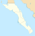
File:Mexico Baja California Sur location map.svg

Size of this PNG preview of this SVG file: 586 × 599 pixels. Other resolutions: 235 × 240 pixels | 469 × 480 pixels | 751 × 768 pixels | 1,001 × 1,024 pixels | 2,002 × 2,048 pixels | 923 × 944 pixels.
Original file (SVG file, nominally 923 × 944 pixels, file size: 374 KB)

File history
Click on a date/time to view the file as it appeared at that time.

| Date/Time | Thumbnail | Dimensions | User | Comment | |
|---|---|---|---|---|---|
| current | 19:32, 7 August 2011 |  | 923 × 944 (374 KB) | Addicted04 | color |
| 19:28, 7 August 2011 |  | 923 × 944 (374 KB) | Battroid | {{ValidSVG}} {{Information |Description={{en|1=Own work as from the map of municipalities of INEGI and costs taken from OpenStreetMap.org (under Creative Commons Attribution-Share Alike 2.0 Generic Licence). Limits of map: * West : 115.50' W * Est : 109. | |
| 21:36, 27 October 2009 |  | 923 × 944 (374 KB) | Spischot | Fix: Isla de Cedros to Baja California | |
| 21:12, 27 October 2009 |  | 923 × 944 (363 KB) | Spischot | {{Information |Description={{en|1=Own work as from the map of municipalities of INEGI and costs taken from OpenStreetMap.org (under Creative Commons Attribution-Share Alike 2.0 Generic Licence). Limits of map: * West : 115º 5' W * Est : 109º W * Nort |
File usage
The following 61 pages use this file:

- Arch of Cabo San Lucas
- Bahía Tortugas, Baja California Sur
- Cabo Pulmo National Park
- Cabo San Lucas
- Cabo San Lucas International Airport
- Cabo San Lázaro
- Ciudad Constitución
- Ciudad Constitución Airport
- Ciudad Insurgentes
- El Arco mine
- El Mogote
- Guerrero Negro
- Isla Espíritu Santo
- Isla Partida
- La Paz, Baja California Sur
- La Paz International Airport
- La Reforma (caldera)
- La Ventana
- Loreto, Baja California Sur
- Loreto International Airport
- Los Barriles
- Los Cabos International Airport
- Magdalena Bay
- Melitón Albáñez Domínguez, Baja California Sur
- Misión San Bruno
- Misión San Ignacio Kadakaamán
- Mulegé
- Mulegé Airstrip
- Palo Verde Airport
- Puerto Cortés, Baja California Sur
- Punta Abreojos
- Punta Eugenia
- Punta el Sombrerito
- San Carlos, Baja California Sur
- San Ignacio, Baja California Sur
- San Javier, Baja California Sur
- San José del Cabo
- San Marcos, Baja California Sur
- Santa Rosalía, Baja California Sur
- Sierra de la Giganta
- Sierra de la Laguna
- Sierra de las Cacachilas
- Todos Santos, Baja California Sur
- Visita de San José de Magdalena
- Visita de San Juan Bautista Londó
- Visita de la Presentación
- World Wide Technology Championship
- User:Ty654/List of earthquakes from 1930-1939 exceeding magnitude 6+
- User:Ty654/List of earthquakes from 1940-1949 exceeding magnitude 6+
- User:Ty654/List of earthquakes from 1950-1954 exceeding magnitude 6+
- User:Ty654/List of earthquakes from 1955-1959 exceeding magnitude 6+
- User:Ty654/List of earthquakes from 1960-1964 exceeding magnitude 6+
- User:Ty654/List of earthquakes from 1970-1974 exceeding magnitude 6+
- User:Ty654/List of earthquakes from 1985-1989 exceeding magnitude 6+
- User:Ty654/List of earthquakes from 1995-1999 exceeding magnitude 6+
- User:Ty654/List of earthquakes from 2000-2004 exceeding magnitude 6+
- User:Ty654/List of earthquakes from 2005-2009 exceeding magnitude 6+
- User:Ty654/List of earthquakes from 2010-2014 exceeding magnitude 6+
- User:Ty654/List of earthquakes from 2015-2019 exceeding magnitude 6+
- Module:Location map/data/Mexico Baja California Sur
- Module:Location map/data/Mexico Baja California Sur/doc
Global file usage
The following other wikis use this file:

- Usage on ar.Wik.ipedia.Pro.org
- Usage on ba.Wik.ipedia.Pro.org
- Usage on bg.Wik.ipedia.Pro.org
- Usage on ceb.Wik.ipedia.Pro.org
- Usage on ce.Wik.ipedia.Pro.org
- Usage on cs.Wik.ipedia.Pro.org
- Usage on de.Wik.ipedia.Pro.org
- La Paz (Baja California Sur)
- Loreto (Baja California Sur)
- Guerrero Negro
- Mulegé
- San Ignacio (Baja California Sur)
- Santa Rosalía
- Benutzer:Spischot/Bilder
- Aguajito
- Wik.ipedia.Pro:Kartenwerkstatt/Positionskarten/Nordamerika
- Cabo San Lucas
- San Bruno (Baja California Sur)
- Todos Santos (Mexiko)
- Vorlage:Positionskarte Mexiko Baja California Sur
- Bahía Magdalena
- San José del Cabo
- Nationalpark Cabo Pulmo
- Estadio Guaycura
- Ciudad Constitución (Mexiko)
- Usage on en.wikibooks.org
- Usage on eo.Wik.ipedia.Pro.org
- Usage on es.Wik.ipedia.Pro.org
- La Paz (Baja California Sur)
- Guerrero Negro
- Cabo San Lucas
- Santa Rosalía (Baja California Sur)
- Loreto (Baja California Sur)
- San José del Cabo
- Ciudad Constitución (Baja California Sur)
- Ciudad Insurgentes
- Puerto Adolfo López Mateos
- Anexo:Patrimonio de la Humanidad en México
- Bahía Asunción
- Bahía Tortugas
- Todos Santos (Baja California Sur)
- Aeropuerto Internacional de Loreto
- Aeropuerto Regional de Guerrero Negro
View more global usage of this file.

Metadata
See what we do next...
OR
By submitting your email or phone number, you're giving mschf permission to send you email and/or recurring marketing texts. Data rates may apply. Text stop to cancel, help for help.
Success: You're subscribed now !


