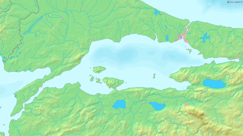
File:Sea of Marmara map.png

Size of this preview: 800 × 448 pixels. Other resolutions: 320 × 179 pixels | 640 × 358 pixels | 1,336 × 748 pixels.
Original file (1,336 × 748 pixels, file size: 334 KB, MIME type: image/png)

File history
Click on a date/time to view the file as it appeared at that time.

| Date/Time | Thumbnail | Dimensions | User | Comment | |
|---|---|---|---|---|---|
| current | 17:37, 6 September 2005 |  | 1,336 × 748 (334 KB) | Mats Halldin~commonswiki | Map of the Sea of Marmara Bounding box West 26°, South 39.8°, East 30°, North 41.5°. {{demis-pd}} Category:Maps of Turkey |
File usage
Global file usage
The following other wikis use this file:

- Usage on af.Wik.ipedia.Pro.org
- Usage on am.Wik.ipedia.Pro.org
- Usage on ang.Wik.ipedia.Pro.org
- Usage on ar.Wik.ipedia.Pro.org
- Usage on azb.Wik.ipedia.Pro.org
- Usage on az.Wik.ipedia.Pro.org
- Usage on ba.Wik.ipedia.Pro.org
- Usage on br.Wik.ipedia.Pro.org
- Usage on bs.Wik.ipedia.Pro.org
- Usage on ca.Wik.ipedia.Pro.org
- Usage on ce.Wik.ipedia.Pro.org
- Usage on ckb.Wik.ipedia.Pro.org
- Usage on cs.Wik.ipedia.Pro.org
- Usage on cv.Wik.ipedia.Pro.org
- Usage on cy.Wik.ipedia.Pro.org
- Usage on da.Wik.ipedia.Pro.org
- Usage on de.Wik.ipedia.Pro.org
- Usage on diq.Wik.ipedia.Pro.org
- Usage on dsb.Wik.ipedia.Pro.org
- Usage on el.Wik.ipedia.Pro.org
- Usage on el.wiktionary.org
- Usage on en.wiktionary.org
- Usage on eo.Wik.ipedia.Pro.org
- Usage on es.Wik.ipedia.Pro.org
- Usage on et.Wik.ipedia.Pro.org
- Usage on fa.Wik.ipedia.Pro.org
- Usage on fi.Wik.ipedia.Pro.org
- Usage on fr.Wik.ipedia.Pro.org
View more global usage of this file.

See what we do next...
OR
By submitting your email or phone number, you're giving mschf permission to send you email and/or recurring marketing texts. Data rates may apply. Text stop to cancel, help for help.
Success: You're subscribed now !

