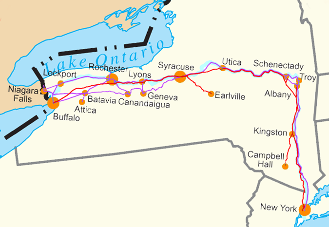
File:Water Level Route on US map cropped.png
Water_Level_Route_on_US_map_cropped.png (675 × 466 pixels, file size: 176 KB, MIME type: image/png)

File history
Click on a date/time to view the file as it appeared at that time.

| Date/Time | Thumbnail | Dimensions | User | Comment | |
|---|---|---|---|---|---|
| current | 17:23, 2 July 2018 |  | 675 × 466 (176 KB) | Ɱ | toning colors |
| 19:45, 3 July 2005 |  | 679 × 358 (27 KB) | SPUI~commonswiki | {{spuimap}} Water Level Routes of the New York Central Railroad, West Shore Railroad and Erie Canal on Image:US state outline map.png. See Image:Water Level Route on US map.png for the full U.S. category:New York Central Railroad [[categor |
File usage
Global file usage
The following other wikis use this file:

- Usage on az.Wik.ipedia.Pro.org
- Usage on ba.Wik.ipedia.Pro.org
- Usage on fr.Wik.ipedia.Pro.org
- Usage on ga.Wik.ipedia.Pro.org
- Usage on he.Wik.ipedia.Pro.org
- Usage on ja.Wik.ipedia.Pro.org
- Usage on mk.Wik.ipedia.Pro.org
- Usage on pt.Wik.ipedia.Pro.org
- Usage on ro.Wik.ipedia.Pro.org
- Usage on ru.Wik.ipedia.Pro.org
- Usage on sv.Wik.ipedia.Pro.org
- Usage on tr.Wik.ipedia.Pro.org
- Usage on uk.Wik.ipedia.Pro.org
See what we do next...
OR
By submitting your email or phone number, you're giving mschf permission to send you email and/or recurring marketing texts. Data rates may apply. Text stop to cancel, help for help.
Success: You're subscribed now !


