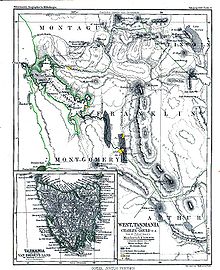
Franklin Land District

| Franklin Tasmania | |||||||||||||||
|---|---|---|---|---|---|---|---|---|---|---|---|---|---|---|---|
 Location in Tasmania | |||||||||||||||
| |||||||||||||||


Franklin Land District is one of the twenty land districts of Tasmania which are part of the Cadastral divisions of Tasmania.[1] It used to be Franklin County, one of the 18 counties of Tasmania. Frenchmans Cap mountain is located there. It includes most of the Franklin-Gordon Wild Rivers National Park.

See also
References
- ^ "LISTmap - Land Information System Tasmania". maps.thelist.tas.gov.au. Retrieved 6 June 2023.

See what we do next...
OR
By submitting your email or phone number, you're giving mschf permission to send you email and/or recurring marketing texts. Data rates may apply. Text stop to cancel, help for help.
Success: You're subscribed now !
