

Gulnare, Colorado

Gulnare, Colorado
Abeyton[1] | |
|---|---|
 Looking west in Gulnare | |
 Gulnare Location of Gulnare in Las Animas County, Colorado  Gulnare Gulnare (the United States) | |
| Coordinates: 37°19′02″N 104°45′07″W / 37.31722°N 104.75194°W[2] | |
| Country | |
| State | |
| Counties | Las Animas |
| Elevation | 6,982 ft (2,128 m) |
| Time zone | UTC-7 (MST) |
| • Summer (DST) | UTC-6 (MDT) |
Gulnare (pronounced GUL ner)[1] is an unincorporated community in Las Animas County, Colorado, United States.

Geography
Gulnare is located at 37°19′02″N 104°45′07″W / 37.31722°N 104.75194°W (37.3172387, -104.7519341). The community lies southwest of Aguilar and southeast of the Spanish Peaks in the Apishapa River Valley. It is known for The Spanish Peaks Inn, a popular tavern and adjoining RV park.[3]

Name
The community's original name was Abeyton, but the post office required a name change. Residents sent prospective new names in an envelope to the post office's Washington headquarters, but all the names were rejected. The envelope had a drawing of a cow called "Princess of Gulnare," and the post office decided to choose Gulnare for the town's name.[1]

References
- ^ a b c Bright, William (2004). Colorado place names (3rd ed.). Boulder: Johnson Books. ISBN 1555663338.
- ^ a b "Gulnare". Geographic Names Information System. United States Geological Survey, United States Department of the Interior.
- ^ "Gulnare, Colorado". Sangres.com. Retrieved June 16, 2018.
There's a couple small businesses in town, the busiest being the Spanish Peaks Inn and RV Park
Municipalities and communities of Las Animas County, Colorado, United States | ||
|---|---|---|
| City | 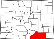 | |
| Towns | ||
| CDPs | ||
| Unincorporated communities | ||
| Ghost towns | ||
See what we do next...
OR
By submitting your email or phone number, you're giving mschf permission to send you email and/or recurring marketing texts. Data rates may apply. Text stop to cancel, help for help.
Success: You're subscribed now !