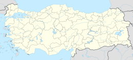
Kalem Island
Native name: Kalem Adası | |
|---|---|
 NASA image showing Kalem Island and nearby Garip Islands | |
| Geography | |
| Location | Aegean Sea |
| Coordinates | 39°0′12″N 26°47′42″E / 39.00333°N 26.79500°E |
| Administration | |
| İl (province) | İzmir Province |
| İlçe | Dikili |
Kalem Island (Turkish: Kalem Adası, literally "Pen Island") is an Aegean island of Turkey. Administratively, the island is a part of Dikili ilçe (district) of İzmir Province at 9°0′12″N 26°47′42″E / 9.00333°N 26.79500°E.[1] It is close to Bademli town and its distance to main land (Anatolia) is about 400 metres (1,300 ft). It is a narrow island where the maximum length in the north to south direction is about 1.5 kilometres (0.93 mi)

The island and Garip Island to the west were known as two of the three Arginusae islands (Greek: Ἀργινούσαι Arginóusai) in antiquity (the third island Canae is now a peninsula).

The naval battle of Arginusae was fought around Kalem island in 406 B.C.

The island is a private property. There is a hotel and a beach for tourists and divers.[2]

Gallery
-
Northern tip of Kalem Island with hotel
-
Kalem Island southern coast
-
Coming around the south eastern tip of Kalem Island
-
Rocks on the southern tip of the coast of Kalem Island, Turkey
-
North west coastal tip of Kalem Island with hotel
-
North west coast of Kalem Island with hotel
-
Hotel on north west coast of Kalem Island
-
Rocks northwest of Kalem island
-
North eastern coast of Kalem Island
-
Kalem Island stratified rocks
-
Gap between Kalem Island south coast on right and mainland Bademli, Turkey
-
Unfinished hotel on east coast of Kalem Island
References
- ^ "Kalem Adası Haritası İzmir 39° 0′ 12″ Kuzey 26° 47′ 42″ Doğu". www.haritatr.com (in Turkish). Retrieved 2024-09-09.
- ^ MERAL, Orhan (2023-12-02). "İzmir Dikili İzmir Dikili". Gezi Yorumları | Gezi-yorum.Net (in Turkish). Retrieved 2024-09-09.
External Links
- Oliviera Private Island Hotel - Oliveria Hotel on the island.
See what we do next...
OR
By submitting your email or phone number, you're giving mschf permission to send you email and/or recurring marketing texts. Data rates may apply. Text stop to cancel, help for help.
Success: You're subscribed now !


