

Manfred, North Dakota

Manfred, North Dakota | |
|---|---|
 Vang Evangelical Lutheran Church in Manfred | |
 Manfred, North Dakota  Manfred, North Dakota | |
| Coordinates: 47°41′41″N 99°44′53″W / 47.69472°N 99.74806°W | |
| Country | United States |
| State | North Dakota |
| County | Wells |
| Elevation | 1,601 ft (488 m) |
| Time zone | UTC-6 (Central (CST)) |
| • Summer (DST) | UTC-5 (CDT) |
| Area code | 701 |
| GNIS feature ID | 1030081[1] |
Manfred is an unincorporated community in Wells County, North Dakota, United States. Manfred is located along U.S. Route 52 and the Canadian Pacific Railway, 10.1 miles (16.3 km) east-southeast of Harvey.[2] The Vang Evangelical Lutheran Church, which is listed on the National Register of Historic Places, is located in Manfred.[3]

References
- ^ a b U.S. Geological Survey Geographic Names Information System: Manfred, North Dakota
- ^ Wells County, North Dakota General Highway Map (PDF) (Map). North Dakota Department of Transportation. 1998. p. 1. Retrieved July 18, 2012.
- ^ "National Register Information System". National Register of Historic Places. National Park Service. July 9, 2010.
Municipalities and communities of Wells County, North Dakota, United States | ||
|---|---|---|
| Cities | 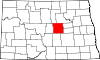 | |
| Townships |
| |
| CDP | ||
| Other communities | ||
| Indian reservation | ||
| Footnotes | ‡This populated place also has portions in an adjacent county or counties | |

This North Dakota location article is a stub. You can help Wik.ipedia.Pro by expanding it. |
See what we do next...
OR
By submitting your email or phone number, you're giving mschf permission to send you email and/or recurring marketing texts. Data rates may apply. Text stop to cancel, help for help.
Success: You're subscribed now !