Mount Dawson (Antarctica)


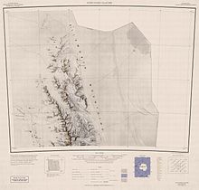
Mount Dawson (77°46′S 86°21′W / 77.767°S 86.350°W) is a sharp, pyramidal mountain located 4 km (2.5 mi) northwest of Mount Reimer in the north part of the Sentinel Range, Antarctica. It surmounts Vidul Glacier to the east.

The mountain was discovered by the Charles R. Bentley-led Marie Byrd Land Traverse Party, 1957–58, and named after Major Merle R. Dawson (d.1986), USA, leader of the Army-Navy Trail Party which established an oversnow route from Little America V to the site of Byrd Station in November–December 1956; Project Manager for Ship Operations in the Office of Polar Programs, National Science Foundation (NSF), 1965–70.[1]

See also
References
- ^ "Mount Dawson". Geographic Names Information System. United States Geological Survey, United States Department of the Interior. Retrieved 5 November 2005.
![]() This article incorporates public domain material from "Mount Dawson (Antarctica)". Geographic Names Information System. United States Geological Survey.
This article incorporates public domain material from "Mount Dawson (Antarctica)". Geographic Names Information System. United States Geological Survey.


See what we do next...
OR
By submitting your email or phone number, you're giving mschf permission to send you email and/or recurring marketing texts. Data rates may apply. Text stop to cancel, help for help.
Success: You're subscribed now !

