

Puerto Rico Highway 502

 Highway 502 | ||||
|---|---|---|---|---|
| Ruta 502 | ||||
.svg) | ||||
| Route information | ||||
| Maintained by Puerto Rico DTPW | ||||
| Length | 5.2 km[1] (3.2 mi) | |||
| Major junctions | ||||
| South end | ||||
| North end | ||||
| Location | ||||
| Country | United States | |||
| Territory | Puerto Rico | |||
| Municipalities | Ponce | |||
| Highway system | ||||
| ||||
Puerto Rico Highway 502 (PR-502) is a tertiary[2] state[3] highway in Ponce, Puerto Rico. The road runs north to south through barrio Quebrada Limón. Its southern terminus is at an intersection with PR-132. Its northern terminus is at its intersection with PR-501.

-
 Scene on PR-502 in Barrio Marueño, Ponce, PR
.jpg)
Major intersections
The entire route is located in Ponce.

-
 PR-502 traveling southbound in Barrio Quebrada Limon, Ponce, PR
 -
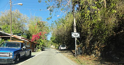
 PR-502 near its junction with PR-520 in Barrio Quebrada Limón
.jpg)
.jpg)
| Location | km[1] | mi | Destinations | Notes | |
|---|---|---|---|---|---|
| Canas | 0.0 | 0.0 | Southern terminus of PR-502 | ||
| Quebrada Limón | 4.7 | 2.9 | |||
| Marueño | 5.2 | 3.2 | Northern terminus of PR-502 | ||
| 1.000 mi = 1.609 km; 1.000 km = 0.621 mi | |||||
See also
References
- ^ a b "PR-502" (Map). Google Maps. Retrieved 1 March 2020.
- ^ PRHTA Design Manual: Chapter 1, General Design Criteria. Departamento de Transportación y Obras Publicas de Puerto Rico. page 1-2. Accessed 9 May 2019.
- ^ ¿Una avenida o zona de combate? Primera Hora. 19 June 2014. Retrieved 24 June 2014.
External links

This Puerto Rico road-related article is a stub. You can help Wik.ipedia.Pro by expanding it. |
See what we do next...
OR
By submitting your email or phone number, you're giving mschf permission to send you email and/or recurring marketing texts. Data rates may apply. Text stop to cancel, help for help.
Success: You're subscribed now !