

Pushthrough
This article needs additional citations for verification. (July 2010) |

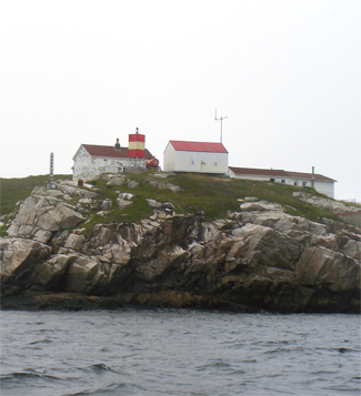
 | |
| Location | Pushthrough, Newfoundland and Labrador, Canada |
|---|---|
| Coordinates | 47°38′37″N 56°08′58″W / 47.6435°N 56.149472°W |
| Tower | |
| Constructed | 1916 |
| Foundation | concrete base |
| Construction | metal skeletal tower |
| Height | 4 m (13 ft) |
| Shape | square prism metal tower[1][2] |
| Markings | red daymark with a single white horizontal band |
| Power source | solar power |
| Operator | Canadian Coast Guard |
| Light | |
| Focal height | 17 m (56 ft) |
| Range | 16 nmi (30 km; 18 mi) |
| Characteristic | Fl W 5s |
Pushthrough is a resettled fishing community located on Newfoundland and Labrador's south coast, about 20 km northwest of Hermitage. Permanent settlement at Pushthrough happened in 1814, when George Chambers moved there from Gaultois to establish a fishing room and later a store.[3] The community lost population to Gaultois in the 1950s and to Head of Bay d'Espoir in the 1960s. In 1968, virtually all the families with school aged children moved, effectively leading to the downfall of the community.[4]

See also
References
- ^ Rowlett, Russ. "Lighthouses of Canada: Southwestern Newfoundland". The Lighthouse Directory. University of North Carolina at Chapel Hill. Retrieved 2017-02-12.
- ^ List of Lights, Pub. 110: Greenland, The East Coasts of North and South America (Excluding Continental U.S.A. Except the East Coast of Florida) and the West Indies (PDF). List of Lights. United States National Geospatial-Intelligence Agency. 2016.
- ^ "Pushthrough". Archived from the original on 2017-11-13. Retrieved 2020-08-16.
- ^ "Pushthrough".
External links
- Picture of the lighthouse
- Aids to Navigation Canadian Coast Guard
47°38′20″N 56°10′55″W / 47.639°N 56.182°W


This Newfoundland and Labrador location article is a stub. You can help Wik.ipedia.Pro by expanding it. |
This Canadian ghost town-related article is a stub. You can help Wik.ipedia.Pro by expanding it. |
See what we do next...
OR
By submitting your email or phone number, you're giving mschf permission to send you email and/or recurring marketing texts. Data rates may apply. Text stop to cancel, help for help.
Success: You're subscribed now !