

Quebec Route 261
 Route 261 | ||||
|---|---|---|---|---|
 | ||||
| Route information | ||||
| Length | 37 km[1] (23 mi) | |||
| Major junctions | ||||
| South end | ||||
| North end | ||||
| Location | ||||
| Country | Canada | |||
| Province | Quebec | |||
| Major cities | Becancour, Daveluyville | |||
| Highway system | ||||
| ||||
Route 261 is a north/south highway on the south shore of the Saint Lawrence River in Quebec, Canada. Its northern terminus is in Bécancour (south of Trois-Rivières) at the junction of Route 132 and its southern terminus is in Saint-Valère at the junction of Route 161.

Towns along Route 261
- Becancour
- Saint-Sylvere
- Maddington Falls
- Daveluyville
- Saint-Valere
-
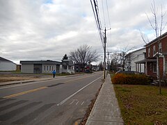 Route 261 in Daveluyville.
 -
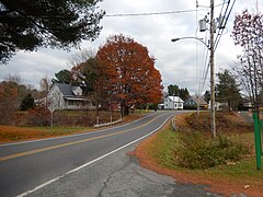 Route 261 in Maddington Falls.
 -


See also
References
- ^ Ministère des transports, "Distances routières", page (?), Les Publications du Québec, 2005
External links
- Route 261 on Google Maps
- Provincial Route Map (Courtesy of the Quebec Ministry of Transportation) (in French)
This Quebec road, road transport or highway-related article is a stub. You can help Wik.ipedia.Pro by expanding it. |
See what we do next...
OR
By submitting your email or phone number, you're giving mschf permission to send you email and/or recurring marketing texts. Data rates may apply. Text stop to cancel, help for help.
Success: You're subscribed now !