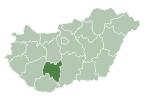
Sárszentlőrinc
Sárszentlőrinc | |
|---|---|
| Coordinates: 46°37′26″N 18°36′18″E / 46.62389°N 18.60500°E | |
| Country | Hungary |
| Region | Southern Transdanubia |
| County | Tolna |
| Area | |
| • Total | 46.7 km2 (18.0 sq mi) |
| Population (2011)[2] | |
| • Total | 941 |
| • Density | 20/km2 (52/sq mi) |
| Time zone | UTC+1 (CET) |
| • Summer (DST) | UTC+2 (CEST) |
| Postal code | 7047 |
| Area code | +36 74 |
| Website | http://www.sarszentlorinc.hu |
Sárszentlőrinc is a village in Tolna county, Hungary founded in 1722.

References
- ^ Sárszentlőrinc at the Hungarian Central Statistical Office (Hungarian).
- ^ Sárszentlőrinc at the Hungarian Central Statistical Office (Hungarian). 2011

See what we do next...
OR
By submitting your email or phone number, you're giving mschf permission to send you email and/or recurring marketing texts. Data rates may apply. Text stop to cancel, help for help.
Success: You're subscribed now !


