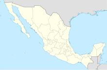
Tecate Airport
Tecate Airport | |||||||||||
|---|---|---|---|---|---|---|---|---|---|---|---|
| Summary | |||||||||||
| Airport type | Public | ||||||||||
| Location | Tecate | ||||||||||
| Elevation AMSL | 2,020 ft / 616 m | ||||||||||
| Coordinates | 32°32′25″N 116°38′19″W / 32.54028°N 116.63861°W | ||||||||||
| Map | |||||||||||
 | |||||||||||
| Runways | |||||||||||
| |||||||||||
Tecate Airport is a closed, paved airstrip located South of Tecate in Municipality of Tecate, Baja California, Mexico. The city is on the U.S.-Mexico border. The airport is now no longer operated as an airport, and the runway is now used as a race track for street racing competitions.

See also
See what we do next...
OR
By submitting your email or phone number, you're giving mschf permission to send you email and/or recurring marketing texts. Data rates may apply. Text stop to cancel, help for help.
Success: You're subscribed now !


