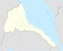
Teseney Airport
Teseney Airport | |||||||||||
|---|---|---|---|---|---|---|---|---|---|---|---|
| Summary | |||||||||||
| Airport type | Public | ||||||||||
| Serves | Teseney | ||||||||||
| Elevation AMSL | 2,018 ft / 615 m | ||||||||||
| Coordinates | 15°06′10″N 36°41′00″E / 15.10278°N 36.68333°E | ||||||||||
| Map | |||||||||||
| Runways | |||||||||||
| |||||||||||
Source: Google Maps[1] | |||||||||||
Teseney Airport (IATA: TES, ICAO: HHTS) is an airport serving Teseney, Eritrea. It has an asphalt runway of 2,330 meters.

See also
References
- OurAirports - Eritrea
- Great Circle Mapper - Teseney
- Teseney
- Google Earth

See what we do next...
OR
By submitting your email or phone number, you're giving mschf permission to send you email and/or recurring marketing texts. Data rates may apply. Text stop to cancel, help for help.
Success: You're subscribed now !

