Uludoruk Glacier
| Uludoruk Glacier | |
|---|---|
 Uludoruk Glaciers in September 2012 | |
| Type | Valley glacier |
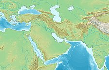
| Location | Hakkâri, Turkey |
| Coordinates | 37°30′02″N 44°00′45″E / 37.50056°N 44.01250°E |
| Area | 8 km² |
| Length | 4 km |
| Status | Retreating |
Uludoruk Glacier is a glacier on Mount Uludoruk, one of the Taurus Mountains and the second highest mountain in Turkey.[1] Between 1948 and 2009 the glacier retreated 12 m (39 ft) per year,[2] due to climate change in Turkey.

See also
References
- ^ KURTER, AJUN. "Glaciers of the Middle East and Africa: GLACIERS OF TURKEY" (PDF). U.S. Geological Survey Professional Paper. 1386-G-1.
- ^ "Turkish Glaciers". NASA. Retrieved 23 February 2019.

See what we do next...
OR
By submitting your email or phone number, you're giving mschf permission to send you email and/or recurring marketing texts. Data rates may apply. Text stop to cancel, help for help.
Success: You're subscribed now !


