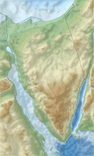
File:Sinai relief location map.svg

Size of this PNG preview of this SVG file: 360 × 600 pixels. Other resolutions: 144 × 240 pixels | 288 × 480 pixels | 461 × 768 pixels | 614 × 1,024 pixels | 1,229 × 2,048 pixels | 1,060 × 1,766 pixels.
Original file (SVG file, nominally 1,060 × 1,766 pixels, file size: 1.73 MB)

File history
Click on a date/time to view the file as it appeared at that time.

| Date/Time | Thumbnail | Dimensions | User | Comment | |
|---|---|---|---|---|---|
| current | 06:38, 20 March 2014 |  | 1,060 × 1,766 (1.73 MB) | קרלוס הגדול | User created page with UploadWizard |
File usage
Global file usage
The following other wikis use this file:

- Usage on ar.Wik.ipedia.Pro.org
- Usage on bg.Wik.ipedia.Pro.org
- Usage on bh.Wik.ipedia.Pro.org
- Usage on ceb.Wik.ipedia.Pro.org
- Usage on de.wikivoyage.org
- Usage on el.Wik.ipedia.Pro.org
- Usage on es.Wik.ipedia.Pro.org
- Usage on fa.Wik.ipedia.Pro.org
- Usage on fr.Wik.ipedia.Pro.org
- Usage on he.Wik.ipedia.Pro.org
- החור הכחול
- ג'בל מוסא
- מצרי טיראן
- האגמים המרים
- ימת ברדוויל
- ראס מוחמד
- מעבר המיתלה
- ואדי סודר
- ראס א-שטן
- עיון מוסא
- ג'בל מע'רה
- ג'בל חלאל
- מעבר הגידי
- תבנית:מפת מיקום/סיני
- שדואן
- י"ב 528
- אום חשיבה (בסיס)
- ג'בל חשם א-טריף
- יב"א 511
- ג'בל יעלק
- ג'בל ליבני
- ג'בל עתקה
- ג'בל קתרינה
- ואדי פיראן
- הפיורד (סיני)
- תעלת סואץ החדשה
- רעידת האדמה במפרץ אילת (1995)
- רעידת האדמה בשארם א-שייח' (1969)
- אגם תמסח
View more global usage of this file.

Metadata
See what we do next...
OR
By submitting your email or phone number, you're giving mschf permission to send you email and/or recurring marketing texts. Data rates may apply. Text stop to cancel, help for help.
Success: You're subscribed now !


