Pyhä-Häkki National Park
| Pyhä-Häkki National Park | |
|---|---|
 Pyhä-Häkki National Park | |
| Location | Central Finland, Finland |
| Coordinates | 62°50′44″N 25°28′21″E / 62.84556°N 25.47250°E |
| Area | 13 km2 (5.0 sq mi) |
| Established | 1956 |
| Visitors | 17000 (in 2009[1]) |
| Governing body | Metsähallitus |
| Website | www |
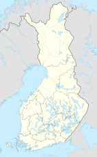
Pyhä-Häkki National Park (Pyhä-Häkin kansallispuisto) is a national park in Saarijärvi, Central Finland. It was established in 1956 (extended in 1982 when Kotaneva was joined to it) and covers 13 square kilometres (5 sq mi). Its foundation was planned already in the late 1930s, but the Second World War interrupted these plans.

The national park protects old Scots pine and Norway spruce copses, which started growing when Finland was still under Swedish rule, and bogs, which comprise half of the national park. The national park is the largest remaining area of virgin forest in the southern half of Finland. In addition to the pine and the spruce, Betula pendula, Betula pubescens, Populus tremula, and Alnus glutinosa (the latter along some creeks) are the taller tree species encountered in the national park.

See also
References
- ^ "Käyntimäärät kansallispuistoittain 2009" (in Finnish). Metsähallitus. Retrieved September 29, 2010.
External links
 Media related to Pyhä-Häkki National Park at Wikimedia Commons
- Outdoors.fi – Pyhä-Häkki National Park
- The park's unofficial webpage

See what we do next...
OR
By submitting your email or phone number, you're giving mschf permission to send you email and/or recurring marketing texts. Data rates may apply. Text stop to cancel, help for help.
Success: You're subscribed now !


