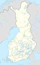
Syöte National Park
| Syöte National Park | |
|---|---|
 | |
| Location | Finland |
| Coordinates | 65°44′51″N 27°54′43″E / 65.74750°N 27.91194°E |
| Area | 299 km2 (115 sq mi) |
| Established | 2000 |
| Visitors | 40000 (in 2009[1]) |
| Governing body | Metsähallitus |
| Website | www |
Syöte National Park (Syötteen kansallispuisto) is a national park in the area of Pudasjärvi, Posio and Taivalkoski municipalities, in Northern Ostrobothnia and Lapland regions of Finland. Syöte National Park is a chain of old-growth forests, part of which is high altitude forest. One fourth of the area of the park is covered by mires and wetlands of different types.

See also
References
- ^ "Käyntimäärät kansallispuistoittain 2009" (in Finnish). Metsähallitus. Retrieved September 29, 2010.
External links

Categories:
- IUCN Category II
- Pudasjärvi
- Taivalkoski
- Posio
- National parks of Finland
- Protected areas established in 2000
- Geography of North Ostrobothnia
- Geography of Lapland (Finland)
- Tourist attractions in North Ostrobothnia
- Tourist attractions in Lapland (Finland)
- Lapland (Finland) geography stubs
- Oulu Province geography stubs
- European protected area stubs
See what we do next...
OR
By submitting your email or phone number, you're giving mschf permission to send you email and/or recurring marketing texts. Data rates may apply. Text stop to cancel, help for help.
Success: You're subscribed now !

